Post
Distance Limits
Using AI and Satellites---“Keeping the Public Safe”

DISTANCE
LIMIT?

WE KNOW THEM ALL
INSTANTLY.
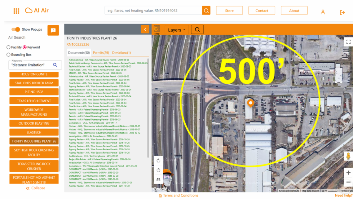
- EnviroAI uses Natural Language Processing (NLP) to identify all facilities with distance limitations in permits and permits-by-rule (and facilities that potentially should have distance limits).
- EnviroAI then uses NLP to identify the particular distance limit for that authorization (which can vary significantly—ex/ 106.262 and individual permit representations).
- EnviroAI finally uses satellite images, aerials, and vision AI to determine what structures of potential concern exist within those distance limits (see analysis below).

IS THE PUBLIC SAFE?
IS A FACILITY IN COMPLIANCE?

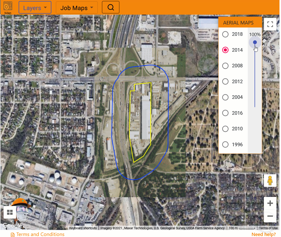
AERIAL TIME-LAPSE ANALYSIS


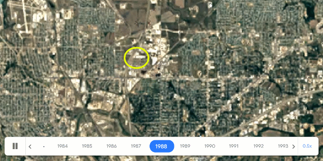
SATELLITE TIME-LAPSE ANALYSIS

Helping companies keep the public safe … EnviroAI

Licensed CC-BY-4.0 .
Original source: Constant Contact campaign
Markdown source: https://jedanderson.org/posts/distance-limits.md
Source on GitHub: /src/content/posts/distance-limits.md
Cite this
BibTeX
@misc{anderson_2021_distance_limits,
  author = {Jed Anderson},
  title  = {Distance Limits},
  year   = {2021},
  url    = {https://jedanderson.org/posts/distance-limits},
  note   = {Accessed: 2026-06-27}
}
APA
Anderson, J. (2021). Distance Limits. Retrieved from https://jedanderson.org/posts/distance-limits
MLA
Anderson, Jed. "Distance Limits." Jed Anderson, September 9, 2021, https://jedanderson.org/posts/distance-limits.